


Antique geographical prints of the Franco - Prussian War, 1870-71
€600.00
In stock
SKU
71461709206201
Description
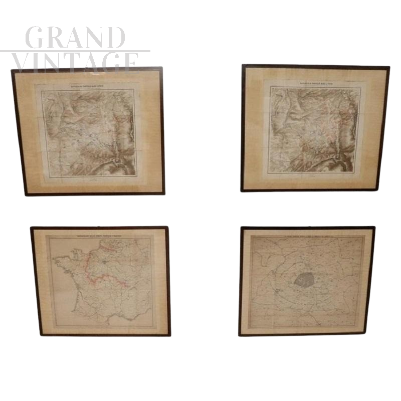
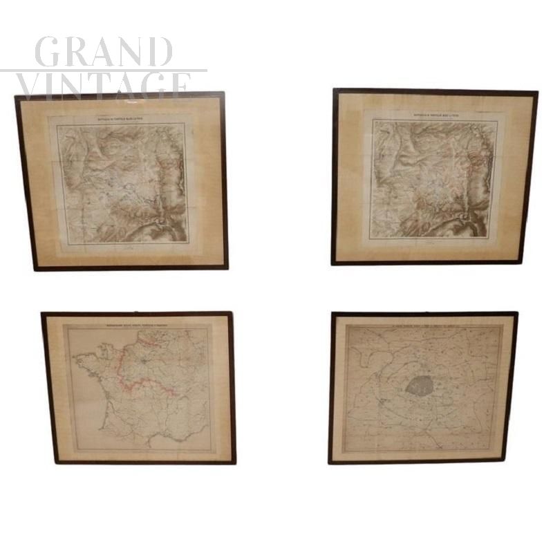
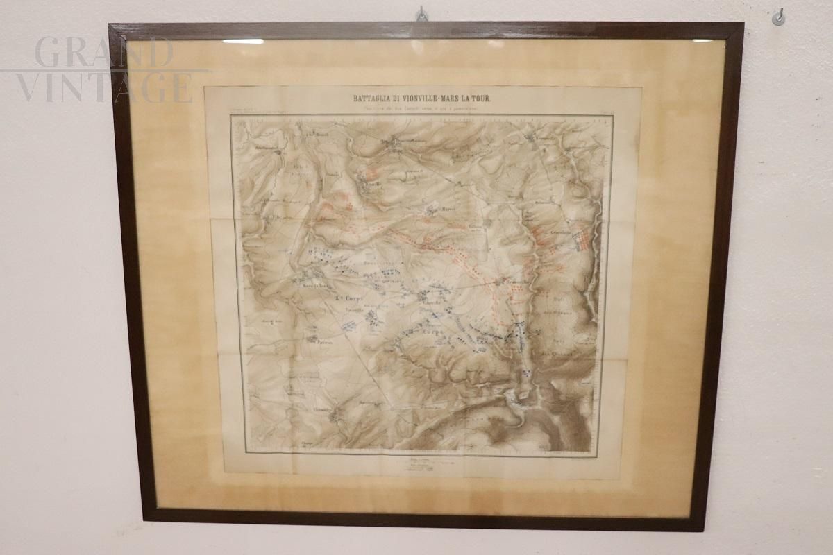
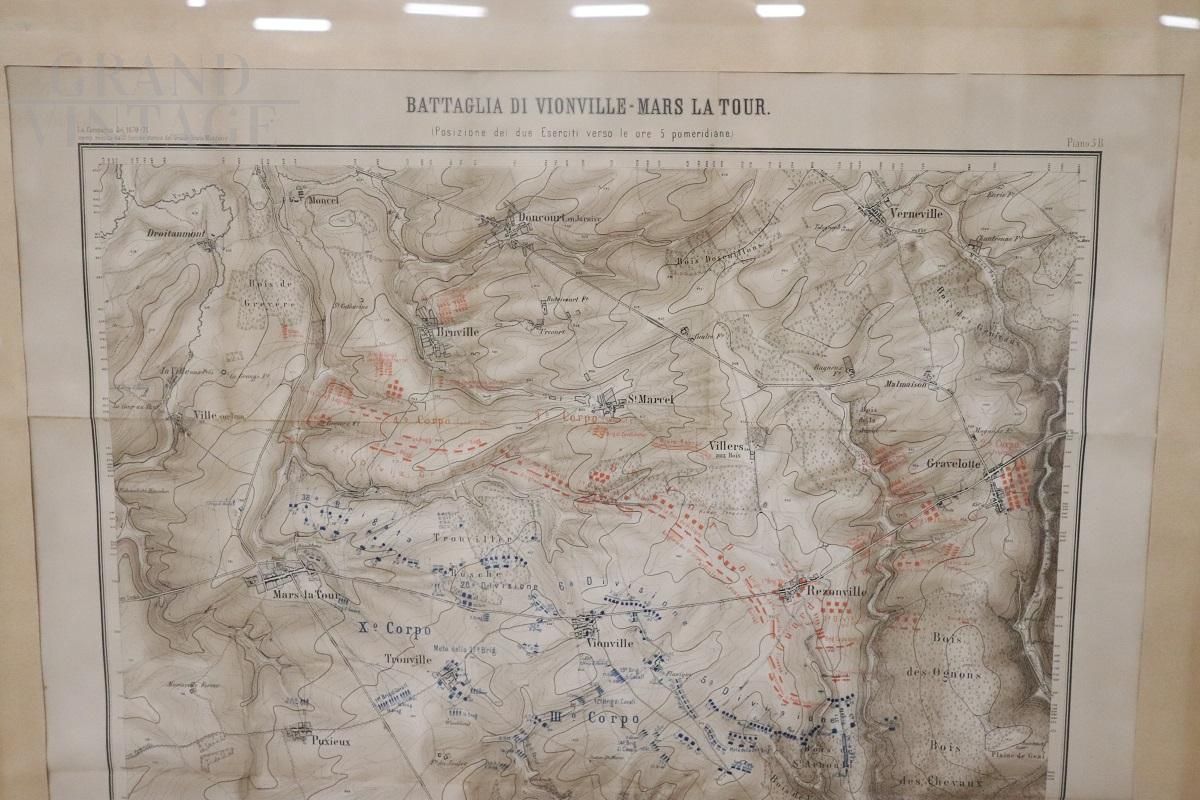
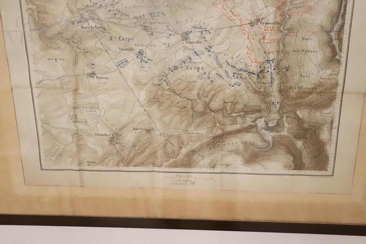
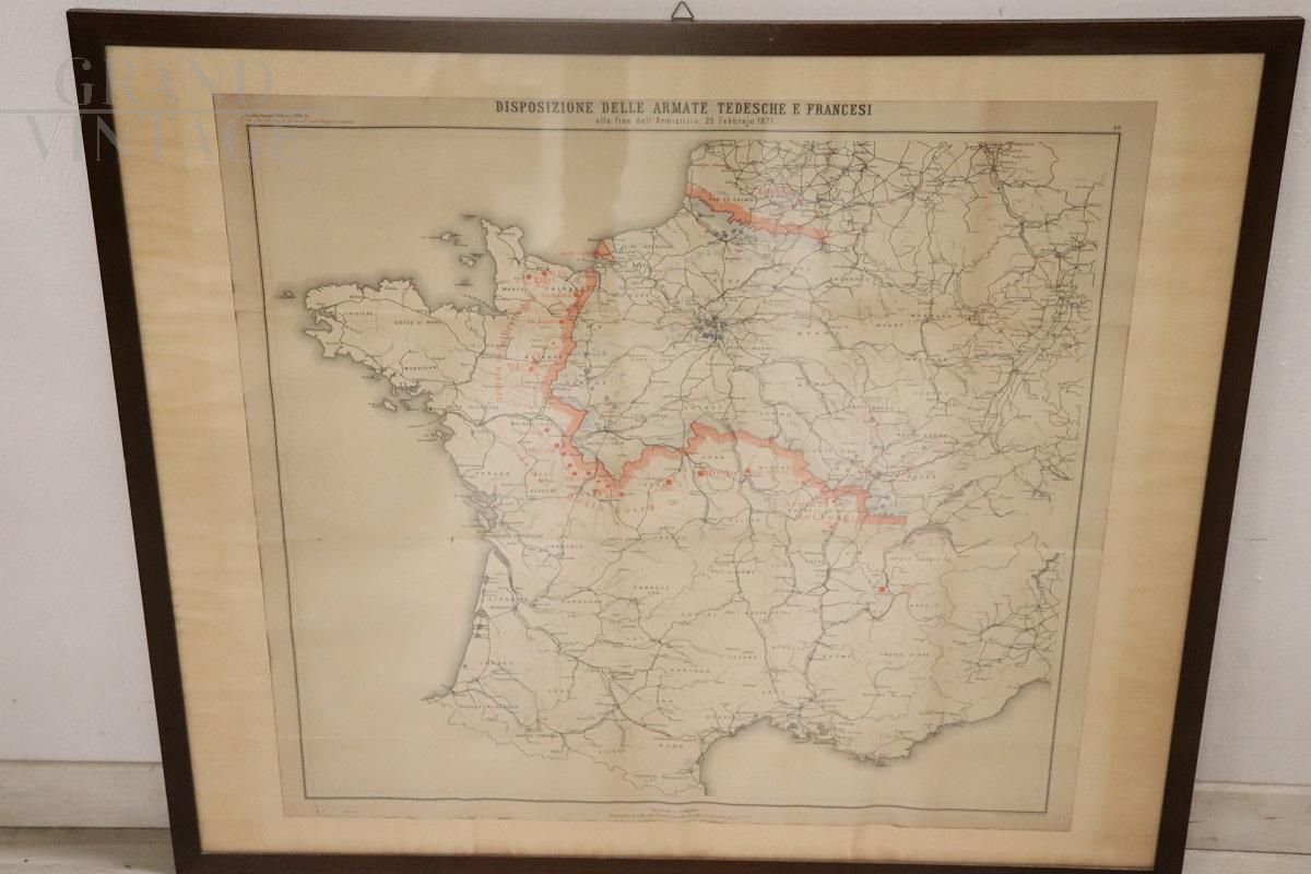
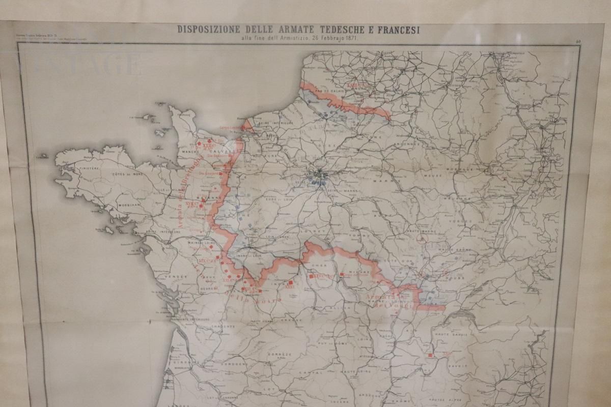
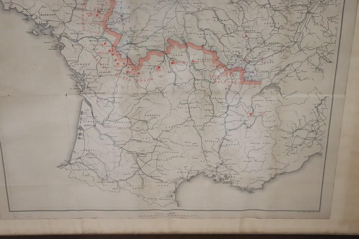
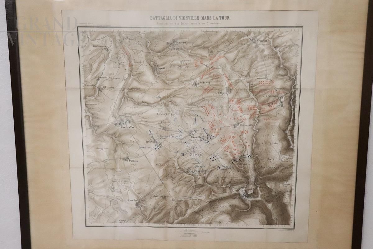
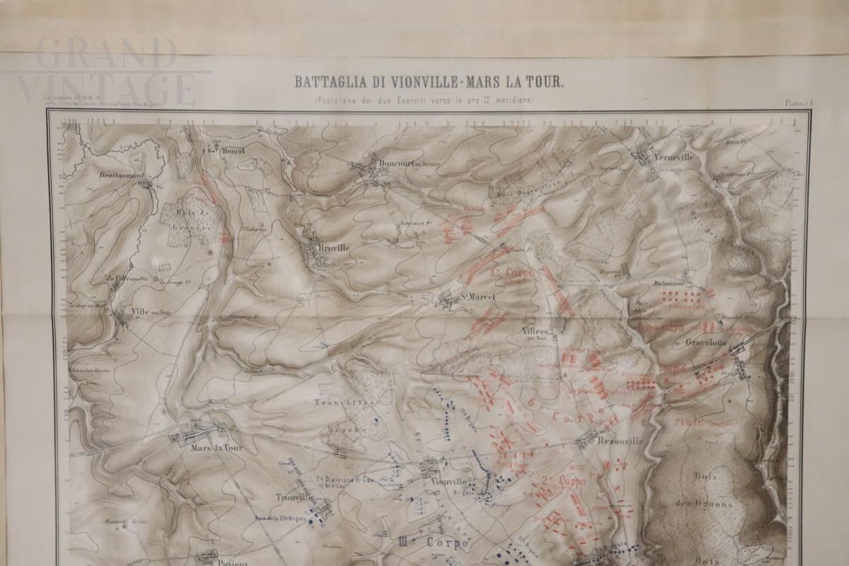
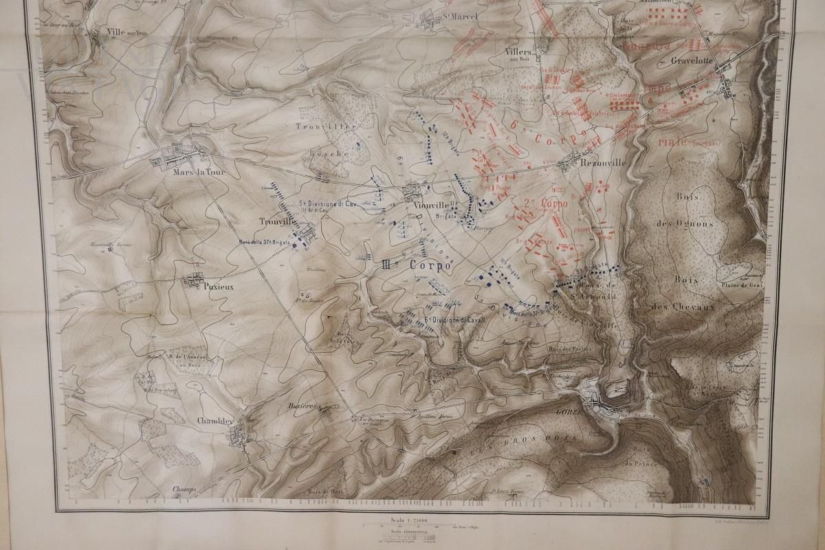
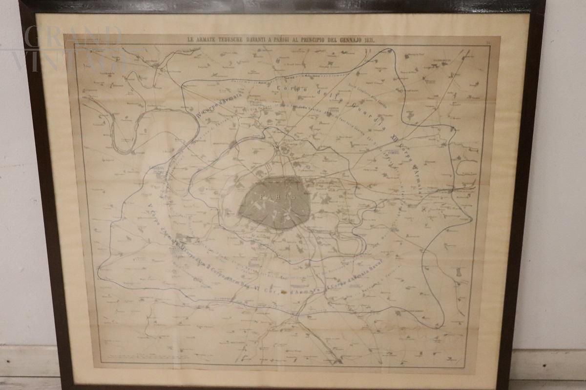
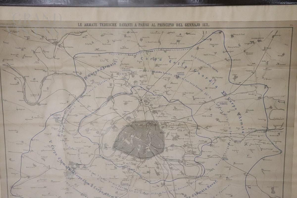
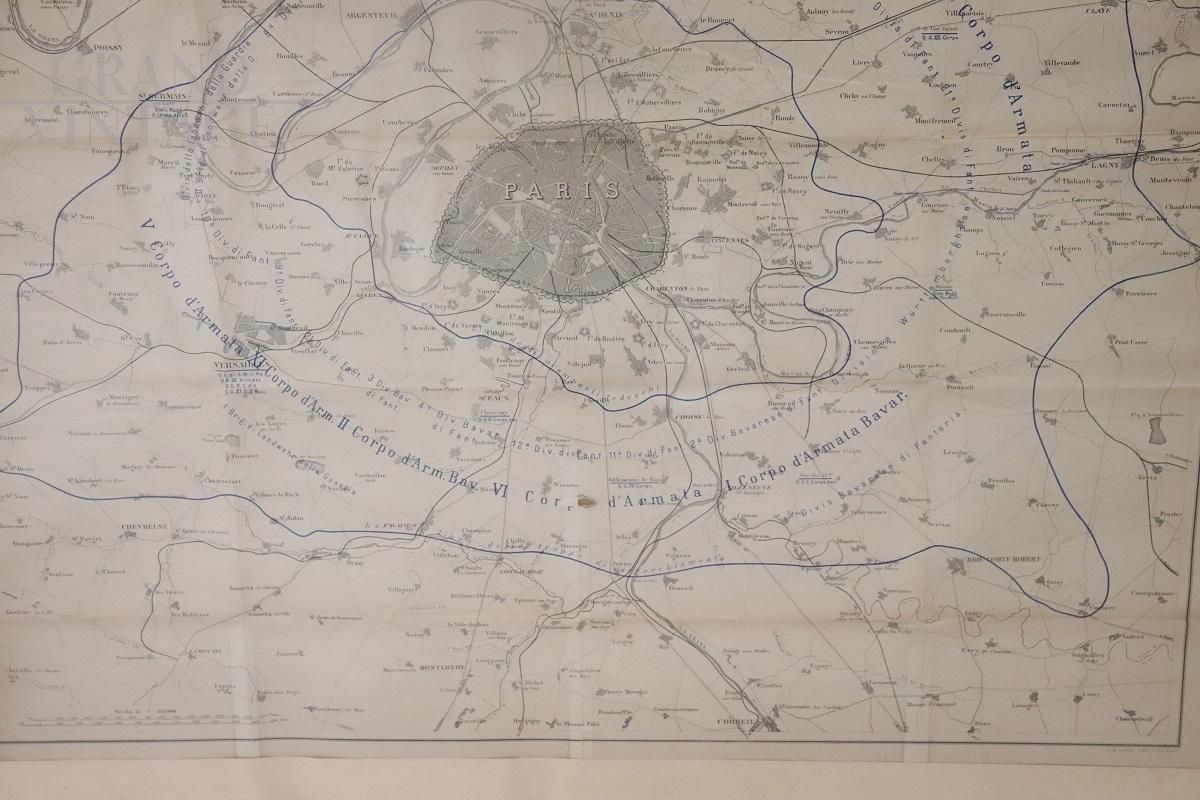
Set of four antique geographical maps relating to the positioning of the armies in the Franco-Prussian War, 1870-71. Author: Historical Section of the Great General Staff. Publisher: Lith Institut Wilh Greve. Good general conditions, natural yellowing of the paper, equipped with a recently manufactured wooden cone. Offered at a negotiable price.
Measurements with frame: Width 93 cm, Height 80 cm.
Dimension
L93 x A80 x P4
Color:
Black and White
Weight:
5 Kg
City:
Alessandria, IT
Material:
Paper
Style:
Classic
Nation:
Condition:
Used

MONEY BACK GUARANTEE
If you are not satisfied with your purchase, you can be reimbursed within 14 days. For more information read the terms of sale
CUSTOMER SERVICE
02 500 412 05assistenza@grandvintage.com
Payment Methods
Pagamento a rate
Send message to seller
Attention. To send a message to the seller, you must first log in or register on the site
Click here for login.